


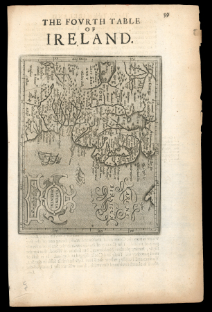


Lot 60014 – Provincial Map: The Fovrth Table of Ireland – Hiberniae
Ireland » Historical Documents
Price realised
100 GBP
Estimate
100 – 150 GBP
Auction date
Tue 9 Dec 2025 at 14:00 (Europe/Zurich)
Description
Provincial Map: The Fovrth Table of Ireland – Hiberniae v Tabula – Gerard Mercator – c1640 An antique regional map of the province of Ulster, which is one of a set of maps which was published in Gerard Mercator’s atlas “Historia Mundi or Mercators Atlas” and printed by T. Cotes. Uncoloured, a fine and clear impression. Approx 165 mm x 130mm.
Delcampe Category: Provincial Map: c1640 An antique regional map of the southern part of Ireland, which is one of a set of maps which was published in Gerard Mercator’s atlas “Historia Mundi or Mercators Atlas” and printed by T. Cotes. Uncoloured, a fine and clear impression. Approx 185 mm x 135mm.
Auction
Catalogue
Additional scans and images are being uploaded on a continuous basis, and the complete set of illustrations for all lots will be available by 1 June 2026.
Should you require further images after this date and are unable to find the material you need online, please do not hesitate to contact us.
For further information regarding this lot, please contact us.