


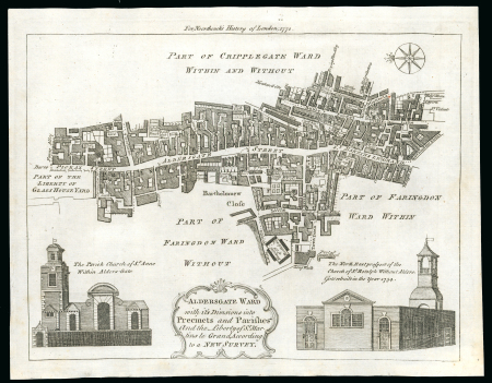
Lot 10301A – 1772c. printed map of Aldersgate ward with its divisions
Lot 10301A – 1772c. printed map of Aldersgate ward with its divisions
Lot 10301A – 1772c. printed map of Aldersgate ward with its divisions
Great Britain » Postal History
Estimation
400 – 500 GBP
Date de vente
Tue 16 Jun 2026 at 10:00 (Europe/Zurich)
19j 9h 26m 51s avant la fin des enchères pré-vente
Description
1772c. printed map of Aldersgate ward with its divisions into preceints and parishes, showing St Martins Le Grand, the eventual site of th General Post Office; superb condition and makes a lovely addition to the story of a postal history exhibit. Rare so fine.
Vente aux enchères
Des scans et images complémentaires sont ajoutés de manière continue, et l’ensemble des illustrations de tous les lots sera disponible d’ici le 1er juin 2026.
Si, après cette date, vous ne trouvez pas les images souhaitées en ligne, nous vous invitons à nous contacter.
Pour toute information complémentaire concernant ce lot, veuillez nous contacter.