


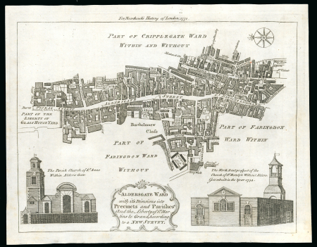
Lot 10301A – 1772c. printed map of Aldersgate ward with its divisions
Lot 10301A – 1772c. printed map of Aldersgate ward with its divisions
Lot 10301A – 1772c. printed map of Aldersgate ward with its divisions
Great Britain » Postal History
Cher collectionneur, nous vous présentons le lot 10301A que vous pouvez maintenant ajouter à votre collection de Great Britain » Postal History. Si vous avez des questions sur nos timbres ou nos lettres, n’hésitez pas à nous contacter ici.
Prix réalisé
Invendu
Estimation
400 – 500 GBP
Date de vente
mar. 16 juin 2026 à 10:00 (Europe/Zurich)
Description
1772c. printed map of Aldersgate ward with its divisions into preceints and parishes, showing St Martins Le Grand, the eventual site of th General Post Office; superb condition and makes a lovely addition to the story of a postal history exhibit. Rare so fine.
Vente aux enchères
Des scans et images complémentaires sont ajoutés de manière continue.
Si vous avez besoin d’images supplémentaires et que vous ne trouvez pas les documents recherchés en ligne, n’hésitez pas à nous contacter.
Pour toute information complémentaire concernant ce lot, veuillez nous contacter.